2022 Map of East Troy
USGS Topo · Published 2022About this map
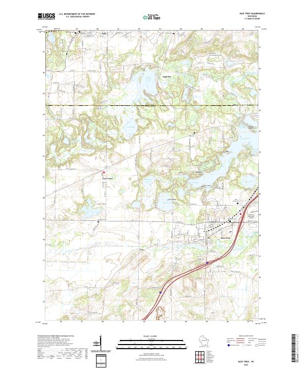
East Troy and the village of Eagle anchor this landscape along the border of Waukesha and Walworth Counties, where the kettle moraine topography is defined by a dense network of lakes and marshes. The Wisconsin Southern RR cuts through the northern sector at Eagle, while the Mukwonago River and Honey Creek drain the undulating terrain. Local heritage is preserved in numerous burial grounds, including the historic Oak Ridge Cem and Saint Peters Cem. Recreational and residential development is concentrated around major water bodies such as Eagle Spring Lake, Lake Beulah, and Booth Lake, with Fairy Island and Beulah Island standing out as prominent landmarks. The presence of the East Troy Municipal Airport and the Rainbow Spring Golf Resort highlights the area's modern character as a hub for both transportation and leisure within the rural Wisconsin countryside.
Find a feature on this map
131 named features on this map. Tap any name to fly to it.
Don’t see what you’re looking for? This feature index may not catch every label — zoom into the map to look around manually.
Map Details
Editions of this 2022 East Troy Map
This is the sole edition of this map. No revisions or reprints were ever made.