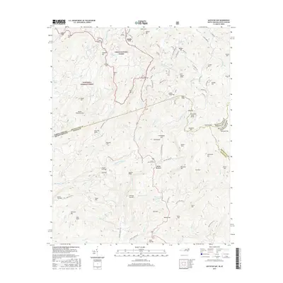
2016 Map of Eastatoe Gap
USGS Topo · Published 2016About this map
Sassafras Mtn stands at the junction of four counties and two states, marking a high point on the Tennessee Valley Divide where the waters of the Middle Fork French Broad River separate from the southern-flowing Eastatoe Cr. The landscape is dominated by the mountainous boundaries of the Pisgah National Forest and Nantahala National Forest, showing a network of high-elevation gaps and ridges such as Line Runner Ridge and Eastatoe Gap. Small settlements like Middle Fork and Rocky Bottom provide glimpses into the remote human history of this borderland. Genealogists can locate family burial sites at Middle Fork Cem, Rocky Bottom Cem, and Masters Cem. The map traces numerous forest roads and trails, including the Arrowhead Trl and Tukey Track, which navigate the complex terrain of Blue Ridge.
Find a feature on this map
123 named features on this map. Tap any name to fly to it.
Don’t see what you’re looking for? This feature index may not catch every label — zoom into the map to look around manually.
Map Details
Editions of this 2016 Eastatoe Gap Map
This is the sole edition of this map. No revisions or reprints were ever made.
Other maps of this area

1888 · Pickens
USGS Topo · 1:125,000

1894 · Pickens
USGS Topo · 1:125,000

1905 · Pisgah
USGS Topo · 1:125,000

1906 · Pisgah
USGS Topo · 1:125,000

1935 · Brevard
USGS Topo · 1:24,000

1935 · Eastatoe Gap
USGS Topo · 1:24,000

1935 · Rosman
USGS Topo · 1:24,000

1935 · Lake Toxaway
USGS Topo · 1:24,000

1935 · Reid
USGS Topo · 1:24,000

1935 · Table Rock
USGS Topo · 1:24,000