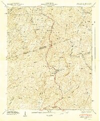
1947 Map of Eastatoe Gap
USGS Topo · Published 1947About this map
Rocky Bottom serves as a central point of settlement in this immediate post-war period, where the Rocky Bottom Sch and Corey Lake sit along the winding Memorial Highway. The landscape is dominated by the convergence of major forest boundaries, including the Nantahala National Forest, Pisgah National Forest, and Sumter National Forest. This intersection of state lines and federal lands highlights the complex geographic management of the Blue Ridge front.
Find a feature on this map
95 named features on this map. Tap any name to fly to it.
Don’t see what you’re looking for? This feature index may not catch every label — zoom into the map to look around manually.
Map Details
Editions of this 1947 Eastatoe Gap Map
This is the sole edition of this map. No revisions or reprints were ever made.
Other maps of this area

1888 · Pickens
USGS Topo · 1:125,000

1894 · Pickens
USGS Topo · 1:125,000

1905 · Pisgah
USGS Topo · 1:125,000

1906 · Pisgah
USGS Topo · 1:125,000

1935 · Brevard
USGS Topo · 1:24,000

1935 · Eastatoe Gap
USGS Topo · 1:24,000

1935 · Rosman
USGS Topo · 1:24,000

1935 · Lake Toxaway
USGS Topo · 1:24,000

1935 · Reid
USGS Topo · 1:24,000

1935 · Table Rock
USGS Topo · 1:24,000