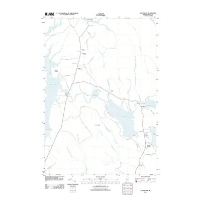
2011 Map of Eastbrook
USGS Topo · Published 2011About this map
Waltham and Eastbrook sit within a landscape defined by an extensive network of waterways and ridges in Hancock County. The eastern portion is dominated by the sprawling waters of Webb Pond and Scammon Pond, the latter of which is controlled by the Scammon Pond Dam. To the west, the East Branch Union River feeds into the northern reaches of Graham Lake near the Webb Brook Dam. Significant terrain features like Waltham Ridge, Hiller Ridge, and Cave Hill rise between these drainages.
Find a feature on this map
72 named features on this map. Tap any name to fly to it.
Don’t see what you’re looking for? This feature index may not catch every label — zoom into the map to look around manually.
Map Details
Editions of this 2011 Eastbrook Map
This is the sole edition of this map. No revisions or reprints were ever made.
Other maps of this area

1911 · Ellsworth
USGS Topo · 1:62,500

1929 · Great Pond
USGS Topo · 1:48,000

1929 · Lead Mountain
USGS Topo · 1:48,000

1930 · Tunk Lake
USGS Topo · 1:48,000

1932 · Tunk Lake
USGS Topo · 1:62,500

1932 · Lead Mountain
USGS Topo · 1:62,500

1932 · Great Pond
USGS Topo · 1:62,500

1940 · Ellsworth
USGS Topo · 1:62,500

1942 · Ellsworth
USGS Topo · 1:62,500

1942 · Tunk Lake
USGS Topo · 1:62,500