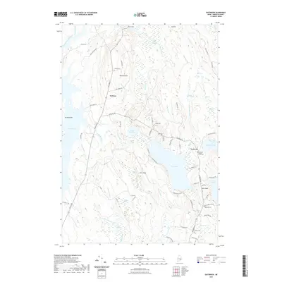
2021 Map of Eastbrook
USGS Topo · Published 2021About this map
Waltham and Eastbrook anchor this Hancock County landscape, where the terrain is defined by a series of north-south ridges and expansive low-lying heaths. The topography is shaped by the waters of Webb Pond and the eastern reaches of Graham Lake, with the land rising toward Waltham Ridge and Mills Ridge. A network of rural routes, including Waltham Rd and Eastbrook Rd, connects small settlements and isolated farmsteads across the undulating terrain. Local heritage is preserved in several burial grounds, such as Hillside Cem, Sunnyside Cem, and the Eastbrook Baptist Church Cem near the Eastbrook Baptist Church. The interior is notably wet, characterized by diverse wetlands like Cook Heath, Morrison Heath, and Casebottle Heath, which reflect the region's complex post-glacial drainage patterns. These natural features, alongside named heights like Hardwood Hill and Cave Hill, illustrate the intersection of traditional Maine land use and a resilient natural environment.
Find a feature on this map
85 named features on this map. Tap any name to fly to it.
Don’t see what you’re looking for? This feature index may not catch every label — zoom into the map to look around manually.
Map Details
Editions of this 2021 Eastbrook Map
This is the sole edition of this map. No revisions or reprints were ever made.
Other maps of this area

1911 · Ellsworth
USGS Topo · 1:62,500

1929 · Great Pond
USGS Topo · 1:48,000

1929 · Lead Mountain
USGS Topo · 1:48,000

1930 · Tunk Lake
USGS Topo · 1:48,000

1932 · Tunk Lake
USGS Topo · 1:62,500

1932 · Lead Mountain
USGS Topo · 1:62,500

1932 · Great Pond
USGS Topo · 1:62,500

1940 · Ellsworth
USGS Topo · 1:62,500

1942 · Ellsworth
USGS Topo · 1:62,500

1942 · Tunk Lake
USGS Topo · 1:62,500