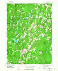
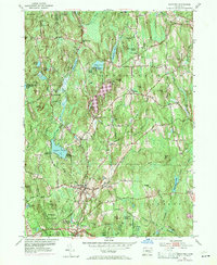
1953 Map of Eastford
USGS Topo · Published 1964About this map
Eastford and Phoenixville anchor this 1950s survey of eastern Connecticut, where the winding Still River and Bungee Brook dictate the settlement patterns of Windham Co. The landscape is a mosaic of conservation and early industry, defined by the extensive Nipmuck State Forest in the north and Natchaug State Forest in the south. These forests are punctuated by small hamlets and rural landmarks like the Red and White Sch and numerous burial grounds, including the Woodstock Central Cem and Spalding Cem.
Find a feature on this map
102 named features on this map. Tap any name to fly to it.
Don’t see what you’re looking for? This feature index may not catch every label — zoom into the map to look around manually.
Map Details
Editions of this 1953 Eastford Map
5 editions found
Other maps of this area

1887 · Brookfield
USGS Topo · 1:62,500

1889 · Webster
USGS Topo · 1:62,500

1889 · Putnam
USGS Topo · 1:62,500

1890 · Brookfield
USGS Topo · 1:62,500

1892 · Woodstock
USGS Topo · 1:62,500

1892 · Webster
USGS Topo · 1:62,500

1893 · Putnam
USGS Topo · 1:62,500

1893 · Brookfield
USGS Topo · 1:62,500

1908 · Quinsigamond
USGS Topo · 1:125,000

1908 · Ware
USGS Topo · 1:125,000