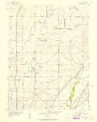
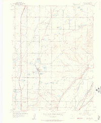
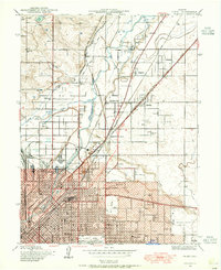
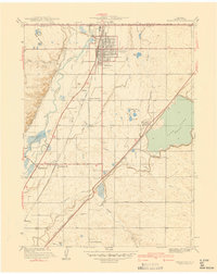
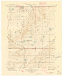
1957 Map of Eastlake
USGS Topo · Published 1958About this map
Agricultural irrigation networks define the landscape of northern Adams County in the late 1950s, where the South Platte River and its many man-made diversions like the German Ditch and Farmers Highline Canal support a cluster of reservoirs. Small rail-dependent settlements such as Eastlake and Hazeltine are centered on the Union Pacific tracks, providing a look at the region's mid-century rural character before the expansive suburban growth of the Denver area reached this far north. The map documents several local institutions including the Brantner Sch, Riverdale Sch, and the Wesley Cem. Notable landmarks of the era include Lake Erie, Ohio Lake, and the modern Valley Highway cutting through the western sections. The presence of numerous family-named reservoirs, such as Richards Reservoir and Smith Reservoir, highlights the critical importance of water rights and local land ownership in this high-plains farming district.
Find a feature on this map
47 named features on this map. Tap any name to fly to it.
Don’t see what you’re looking for? This feature index may not catch every label — zoom into the map to look around manually.
Map Details
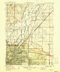
Editions of this 1957 Eastlake Map
2 editions found
Other maps of this area

1890 · East Denver
USGS Topo · 1:125,000

1899 · West Denver
USGS Topo · 1:125,000

1902 · Greeley
USGS Topo · 1:125,000

1904 · Niwot
USGS Topo · 1:62,500
1938 · Derby
USGS Topo · 1:24,000

1938 · Long Branch
USGS Topo · 1:24,000
1940 · Brighton
USGS Topo · 1:31,680

1940 · Eastlake
USGS Topo · 1:31,680
1940 · Lafayette
USGS Topo · 1:31,680
1940 · Derby
USGS Topo · 1:31,680