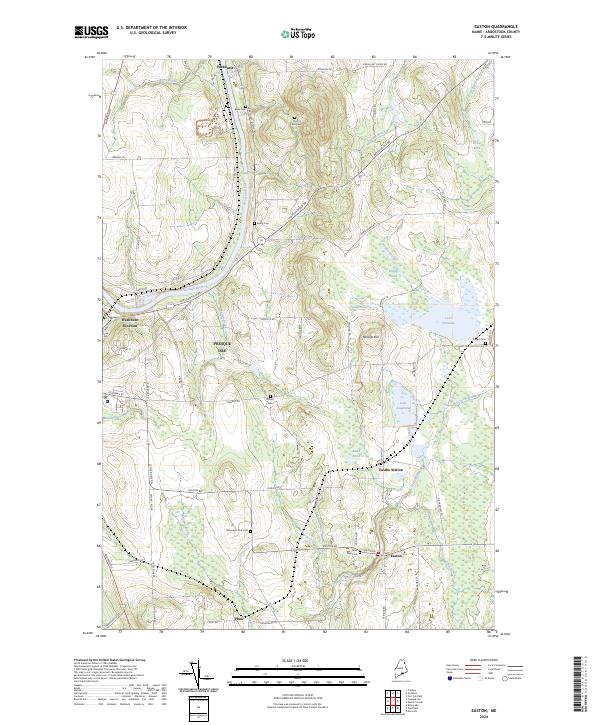
2024 Map of Easton
USGS Topo · Published 2024About this map
The Aroostook River winds through the northern portion of this landscape, anchoring a region defined by agricultural heritage and small-town development. Centered on the eastern edge of Presque Isle, the map illustrates a network of roads like Fort Fairfield Rd and Easton Rd connecting scattered farmsteads and rural cemeteries. These small burial grounds, including Dyer Farm Cem and Beans Cem, offer clear evidence of family landholdings and early settlement patterns across the county.
Find a feature on this map
71 named features on this map. Tap any name to fly to it.
Don’t see what you’re looking for? This feature index may not catch every label — zoom into the map to look around manually.
Map Details
Editions of this 2024 Easton Map
This is the sole edition of this map. No revisions or reprints were ever made.
Other maps of this area

1929 · Caribou
USGS Topo · 1:48,000

1930 · Fort Fairfield
USGS Topo · 1:48,000

1932 · Caribou
USGS Topo · 1:62,500

1933 · Fort Fairfield
USGS Topo · 1:62,500

1935 · Presque Isle
USGS Topo · 1:62,500

1936 · Mars Hill
USGS Topo · 1:48,000

1940 · Mars Hill
USGS Topo · 1:62,500

1951 · Mars Hill
USGS Topo · 1:62,500

1951 · Fort Fairfield
USGS Topo · 1:62,500

1953 · Presque Isle
USGS Topo · 1:62,500