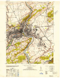
1953 Map of Easton
USGS Topo · Published 1953About this map
The Delaware River and Lehigh River converge at the heart of this mid-century industrial corridor, where the urban centers of Easton and Phillipsburg span the state line. This landscape is a complex network of transportation and heavy industry, featuring the Morris Canal, the Pennsylvania Canal, and multiple rail lines like the Central Railroad of New Jersey. The map details the transition from dense city blocks to the specialized industrial sites of the Vulcanite Cement Co and Ingersoll Rand Co. Beyond the manufacturing cores, the terrain rises into Chestnut Hill and Marble Mountain, dotted with local landmarks like the Fire Lookout Tower near Glendon and numerous neighborhood schools such as the Chief Tatamy School and Breisinger School. Genealogists will find value in the precise locations of the Hays Cemetery and several parish churches like St Anthonys and St James Church.
Find a feature on this map
78 named features on this map. Tap any name to fly to it.
Don’t see what you’re looking for? This feature index may not catch every label — zoom into the map to look around manually.
Map Details
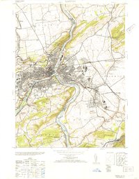
Editions of this 1953 Easton Map
2 editions found
Other maps of this area

1890 · Easton
USGS Topo · 1:62,500

1891 · Easton
USGS Topo · 1:62,500

1891 · Delaware Water Gap
USGS Topo · 1:62,500

1893 · Delaware Water Gap
USGS Topo · 1:62,500

1894 · Allentown
USGS Topo · 1:62,500

1914 · Wind Gap
USGS Topo · 1:62,500

1916 · Wind Gap
USGS Topo · 1:62,500

1932 · Easton
USGS Topo · 1:62,500

1936 · Delaware Water Gap
USGS Topo · 1:48,000

1939 · Allentown
USGS Topo · 1:62,500