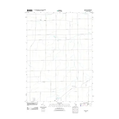
2011 Map of Easton
USGS Topo · Published 2011About this map
Easton and Kerby anchor this section of Shiawassee County, where the landscape is defined by a dense grid of township roads and several prominent watercourses. The drainage of Northwood Creek, Porter Creek, and Sixmile Creek winds through the agricultural terrain, influencing the placement of early infrastructure. Two significant sites for local genealogists and historians appear here: Easton Cemetery, located near the northern border, and Wilkinson Cemetery further south. The map reflects a rural environment where long-established property lines are preserved by roads like N State Rd and Easton Rd, illustrating the transition from 19th-century settlement patterns into the 21st century.
Find a feature on this map
41 named features on this map. Tap any name to fly to it.
Don’t see what you’re looking for? This feature index may not catch every label — zoom into the map to look around manually.
Map Details
Editions of this 2011 Easton Map
This is the sole edition of this map. No revisions or reprints were ever made.
Other maps of this area

1917 · Chesaning
USGS Topo · 1:62,500

1919 · Burt
USGS Topo · 1:62,500

1921 · Burt
USGS Topo · 1:62,500

1922 · Durand
USGS Topo · 1:62,500

1926 · Corunna
USGS Topo · 1:62,500

1929 · Corunna
USGS Topo · 1:62,500

1943 · Burt
USGS Topo · 1:62,500

1943 · Chesaning
USGS Topo · 1:62,500

1943 · Durand
USGS Topo · 1:62,500

1944 · Corunna
USGS Topo · 1:62,500
Featured Places
- Hazelton Township, MI
- Venice Township, MI
- Caledonia Charter Township, MI
- New Haven Township, MI
- Easton, MI