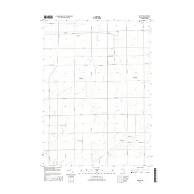
2014 Map of Easton
USGS Topo · Published 2014About this map
Easton remains a primary point of interest in this section of Shiawassee County, anchoring a landscape defined by an intricate network of agricultural water management systems. The terrain is marked by essential local waterways such as Northwood Cr, which flows through the northern reaches, and the engineered courses of Kinsman Drain and Coon Drain. These features reflect the long-standing importance of drainage and irrigation to the region's rural economy. This 2014 survey captures the persistence of the traditional road grid and field patterns that have shaped the local community for generations, providing a clear view of the intersection of natural hydrology and human-made land improvements in Hazelton Township.
Find a feature on this map
4 named features on this map. Tap any name to fly to it.
Don’t see what you’re looking for? This feature index may not catch every label — zoom into the map to look around manually.
Map Details
Editions of this 2014 Easton Map
This is the sole edition of this map. No revisions or reprints were ever made.
Other maps of this area

1917 · Chesaning
USGS Topo · 1:62,500

1919 · Burt
USGS Topo · 1:62,500

1921 · Burt
USGS Topo · 1:62,500

1922 · Durand
USGS Topo · 1:62,500

1926 · Corunna
USGS Topo · 1:62,500

1929 · Corunna
USGS Topo · 1:62,500

1943 · Burt
USGS Topo · 1:62,500

1943 · Chesaning
USGS Topo · 1:62,500

1943 · Durand
USGS Topo · 1:62,500

1944 · Corunna
USGS Topo · 1:62,500
Featured Places
- Hazelton Township, MI
- Venice Township, MI
- Caledonia Charter Township, MI
- New Haven Township, MI
- Easton, MI