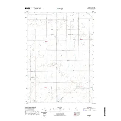
2019 Map of Easton
USGS Topo · Published 2019About this map
Easton and Kerby serve as the primary hubs in this agricultural landscape of Shiawassee County. The terrain is defined by an extensive network of water management features, including the Coal Mine Drain, Coon Drain, and Galloway Drain, which reflect the region's historic reliance on drainage systems to support productive farmland. Genealogy researchers will find several well-documented burial sites such as Easton Cem, Vietz Cem, and Wilkinson Cem situated along the township's section roads. Natural waterways like Porter Cr and Sixmile Cr meander through the woodlots that separate the geometric fields. The grid of roads, including N Geeck Rd and N Kerby Rd, illustrates the persistent township and range organization that has shaped local property lines and settlement patterns since the nineteenth century.
Find a feature on this map
56 named features on this map. Tap any name to fly to it.
Don’t see what you’re looking for? This feature index may not catch every label — zoom into the map to look around manually.
Map Details
Editions of this 2019 Easton Map
This is the sole edition of this map. No revisions or reprints were ever made.
Other maps of this area

1917 · Chesaning
USGS Topo · 1:62,500

1919 · Burt
USGS Topo · 1:62,500

1921 · Burt
USGS Topo · 1:62,500

1922 · Durand
USGS Topo · 1:62,500

1926 · Corunna
USGS Topo · 1:62,500

1929 · Corunna
USGS Topo · 1:62,500

1943 · Burt
USGS Topo · 1:62,500

1943 · Chesaning
USGS Topo · 1:62,500

1943 · Durand
USGS Topo · 1:62,500

1944 · Corunna
USGS Topo · 1:62,500
Featured Places
- Hazelton Township, MI
- Venice Township, MI
- Caledonia Charter Township, MI
- New Haven Township, MI
- Easton, MI