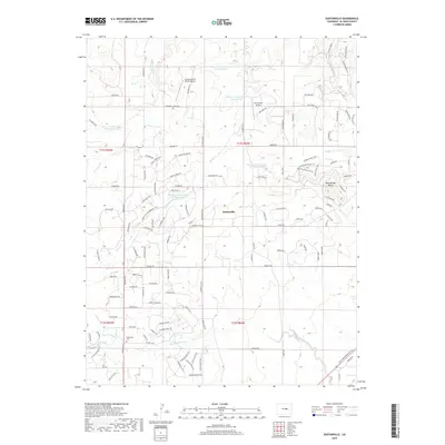
2019 Map of Eastonville
USGS Topo · Published 2019About this map
Eastonville sits as a central point of reference in this El Paso County landscape, where the high plains transition through the Palmer Divide. The area is defined by a network of drainage basins, including Kiowa Cr and Black Squirrel Cr, and is dotted with evidence of early settlement such as Bluff Cem and Eastonville Cem. This 2019 survey illustrates the modern residential development and road networks that have replaced older ranching patterns, though landmarks like Rattlesnake Butte remain prominent topographical features. The map documents significant local infrastructure such as the Cherokee Trail Ranch Airport and the recreational Palmer Divide Regional Trail. These layers of transportation, from the historic wagon-era routes to private airstrips and regional trails, reflect the long-term evolution of Colorado's front range rural communities.
Find a feature on this map
117 named features on this map. Tap any name to fly to it.
Don’t see what you’re looking for? This feature index may not catch every label — zoom into the map to look around manually.
Map Details
Editions of this 2019 Eastonville Map
This is the sole edition of this map. No revisions or reprints were ever made.
Other maps of this area
1893 · Big Springs
USGS Topo · 1:125,000
1893 · Colorado Springs
USGS Topo · 1:125,000
1894 · Castle Rock
USGS Topo · 1:125,000
1909 · Colorado Springs
USGS Topo · 1:125,000
1913 · Castle Rock
USGS Topo · 1:125,000
1940 · Elbert
USGS Topo · 1:62,500
1942 · Colorado Springs
USGS Topo · 1:125,000
1944 · Elbert
USGS Topo · 1:62,500
1948 · Falcon
USGS Topo · 1:24,000
1948 · Falcon
USGS Topo · 1:62,500