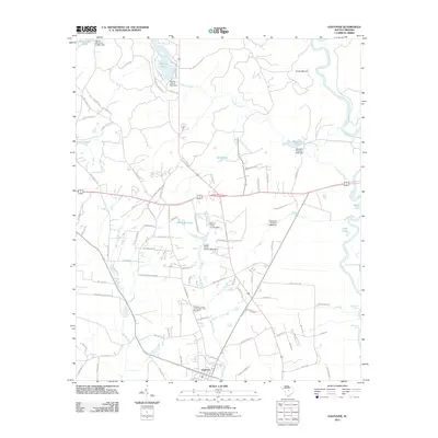
2011 Map of Eastover
USGS Topo · Published 2011About this map
Eastover serves as the focal point of this 2011 survey, situated in a landscape defined by the drainage systems of the Wateree River and Colonels Creek. The map documents a rural transition where agricultural land meets managed water resources, as evidenced by a series of engineered structures like the Wilson Mill Pond D-0594 Dam and Goodwill Pond D-0597 Dam. Notable local landmarks include Cooks Mount and the oxbow waters of Myers Lake and Cove Lake near the river's winding path.
Find a feature on this map
92 named features on this map. Tap any name to fly to it.
Don’t see what you’re looking for? This feature index may not catch every label — zoom into the map to look around manually.
Map Details
Editions of this 2011 Eastover Map
This is the sole edition of this map. No revisions or reprints were ever made.
Other maps of this area

1935 · Killian
USGS Topo · 1:48,000

1937 · Killian
USGS Topo · 1:62,500

1938 · Hagood
USGS Topo · 1:62,500

1941 · Spartanburg
USGS Topo · 1:250,000

1942 · Camden
USGS Topo · 1:125,000

1943 · Eastover
USGS Topo · 1:62,500

1948 · Hopkins
USGS Topo · 1:62,500

1953 · Messers Pond
USGS Topo · 1:24,000

1953 · Poinsett State Park
USGS Topo · 1:24,000

1953 · Eastover
USGS Topo · 1:24,000