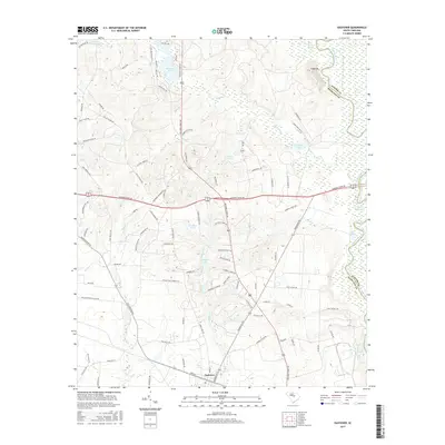
2017 Map of Eastover
USGS Topo · Published 2017About this map
Eastover serves as the primary settlement on this landscape where the lower Midlands of South Carolina meet the expansive Wateree River basin. The geography is defined by a dense network of blackwater drainages and wetlands, including White Marsh Swamp and Wateree Swamp, which flank the river's meandering course. A notable topographic exception is Cooks Mt, rising above the surrounding lowlands near the confluence of Colonels Cr and the river. Numerous small impoundments such as Wilson Mill Pond, Murray Pond, and Goodwill Pond suggest a history of water management for local industry or agriculture. The road network, featuring names like Old Eastover Rd and Garners Ferry Rd, reflects long-standing transit corridors connecting the river valley to the regional interior. This survey captures the rural character of the area, where timberlands and small water bodies like Krelldire Pond dominate the terrain between the town and the county boundary at Sumter Co.
Find a feature on this map
94 named features on this map. Tap any name to fly to it.
Don’t see what you’re looking for? This feature index may not catch every label — zoom into the map to look around manually.
Map Details
Editions of this 2017 Eastover Map
This is the sole edition of this map. No revisions or reprints were ever made.
Other maps of this area

1935 · Killian
USGS Topo · 1:48,000

1937 · Killian
USGS Topo · 1:62,500

1938 · Hagood
USGS Topo · 1:62,500

1941 · Spartanburg
USGS Topo · 1:250,000

1942 · Camden
USGS Topo · 1:125,000

1943 · Eastover
USGS Topo · 1:62,500

1948 · Hopkins
USGS Topo · 1:62,500

1953 · Messers Pond
USGS Topo · 1:24,000

1953 · Poinsett State Park
USGS Topo · 1:24,000

1953 · Eastover
USGS Topo · 1:24,000