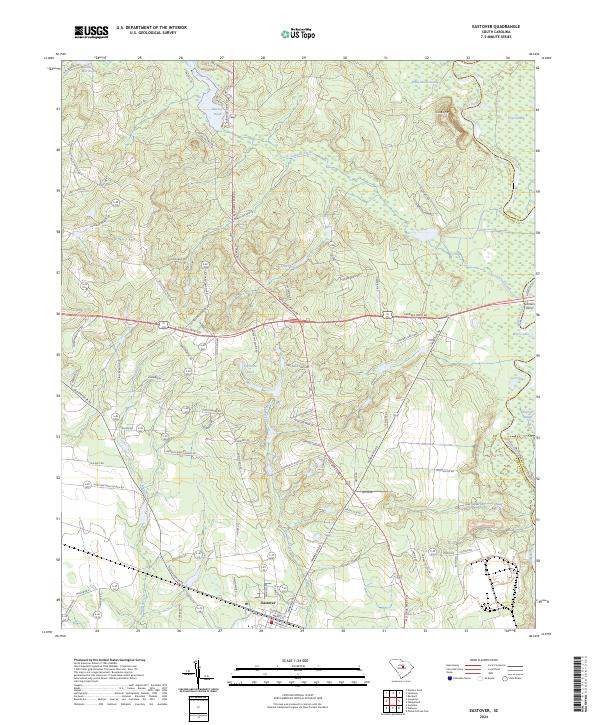
2024 Map of Eastover
USGS Topo · Published 2024About this map
Eastover serves as the primary settlement on this South Carolina landscape, situated at a junction of historic routes and newer residential developments. The terrain is defined by the transition from upland drainage to the alluvial bottomlands of the Wateree River, which forms the boundary with Sumter County. This interface creates a complex hydrology of standing water and slow-moving runs, including the expansive Wateree Swamp, Gum Swamp, and White Marsh Swamp. Family-named landmarks and local roads like Antioch Amez Church Rd and Saint Matthew Church Rd point to the long-established social and religious fabric of the community.
Find a feature on this map
96 named features on this map. Tap any name to fly to it.
Don’t see what you’re looking for? This feature index may not catch every label — zoom into the map to look around manually.
Map Details
Editions of this 2024 Eastover Map
This is the sole edition of this map. No revisions or reprints were ever made.
Other maps of this area

1935 · Killian
USGS Topo · 1:48,000

1937 · Killian
USGS Topo · 1:62,500

1938 · Hagood
USGS Topo · 1:62,500

1941 · Spartanburg
USGS Topo · 1:250,000

1942 · Camden
USGS Topo · 1:125,000

1943 · Eastover
USGS Topo · 1:62,500

1948 · Hopkins
USGS Topo · 1:62,500

1953 · Messers Pond
USGS Topo · 1:24,000

1953 · Poinsett State Park
USGS Topo · 1:24,000

1953 · Eastover
USGS Topo · 1:24,000