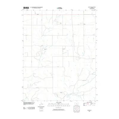
2010 Map of Eaton
USGS Topo · Published 2010About this map
The small settlements of Tisdale and Eaton anchor this portion of Cowley County, representing the persistent agricultural and energy-producing character of the Kansas landscape. The terrain is defined by a dense network of watercourses, most notably the winding path of Grouse Creek and its many tributaries like Silver Creek, Horse Creek, and Pebble Creek. These waterways dictate the local geography, with roads often following the section lines around the creek beds.
Find a feature on this map
32 named features on this map. Tap any name to fly to it.
Don’t see what you’re looking for? This feature index may not catch every label — zoom into the map to look around manually.
Map Details
Editions of this 2010 Eaton Map
This is the sole edition of this map. No revisions or reprints were ever made.
Other maps of this area

1889 · Burden
USGS Topo · 1:125,000

1955 · Wichita
USGS Topo · 1:250,000

1958 · Wichita
USGS Topo · 1:250,000

1962 · Dexter SW
USGS Topo · 1:24,000

1962 · Dexter
USGS Topo · 1:24,000

1962 · Cambridge
USGS Topo · 1:24,000

1964 · Burden
USGS Topo · 1:24,000
1964 · Maple City
USGS Topo · 1:24,000

1965 · Silverdale
USGS Topo · 1:24,000

1965 · Eaton
USGS Topo · 1:24,000