
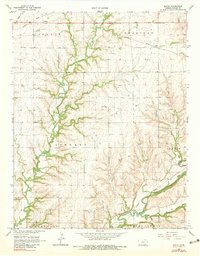
1965 Map of Eaton
USGS Topo · Published 1966About this map
Albright Oil Field and the Cabin Valley Oil Field define the industrial footprint of this Cowley County landscape during the mid-1960s. The terrain is deeply etched by a network of drainage systems, most notably Grouse Creek, Silver Creek, and Maddox North, which wind through the townships of Tisdale, Sheridan, Liberty, and Dexter. Small agricultural and rail settlements like Tisdale and Eaton sit along the Missouri Pacific railroad line in the northern portion of the quadrangle.
Find a feature on this map
27 named features on this map. Tap any name to fly to it.
Don’t see what you’re looking for? This feature index may not catch every label — zoom into the map to look around manually.
Map Details
Editions of this 1965 Eaton Map
2 editions found
Other maps of this area

1889 · Burden
USGS Topo · 1:125,000

1955 · Wichita
USGS Topo · 1:250,000

1958 · Wichita
USGS Topo · 1:250,000

1962 · Dexter SW
USGS Topo · 1:24,000

1962 · Dexter
USGS Topo · 1:24,000

1962 · Cambridge
USGS Topo · 1:24,000

1964 · Burden
USGS Topo · 1:24,000
1964 · Maple City
USGS Topo · 1:24,000

1965 · Silverdale
USGS Topo · 1:24,000

1965 · Winfield
USGS Topo · 1:24,000