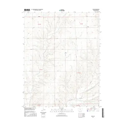
2015 Map of Eaton
USGS Topo · Published 2015About this map
Tisdale and the small settlement of Eaton anchor this portion of Cowley County, defined by a dendritic network of streams feeding into the larger drainage of Grouse Creek. The landscape is etched by numerous watercourses including Silver Cr, Snake Cr, and Pebble Cr, which dictate the placement of rural roads and homesteads. The section lines are clearly marked by a systematic grid of thoroughfares like 171st Rd and 201st Rd, though the topography remains dominated by the natural draws of Harper Cr and Horse Cr. The Prairie Ridge Cem stands as a significant genealogical landmark for those researching local family histories in this rural Kansas township. This survey reflects the enduring agricultural character of the region, where the interplay of high prairie plateaus and carved creek valleys has shaped land use and habitation patterns since the early days of settlement.
Find a feature on this map
38 named features on this map. Tap any name to fly to it.
Don’t see what you’re looking for? This feature index may not catch every label — zoom into the map to look around manually.
Map Details
Editions of this 2015 Eaton Map
This is the sole edition of this map. No revisions or reprints were ever made.
Other maps of this area

1889 · Burden
USGS Topo · 1:125,000

1955 · Wichita
USGS Topo · 1:250,000

1958 · Wichita
USGS Topo · 1:250,000

1962 · Dexter SW
USGS Topo · 1:24,000

1962 · Dexter
USGS Topo · 1:24,000

1962 · Cambridge
USGS Topo · 1:24,000

1964 · Burden
USGS Topo · 1:24,000
1964 · Maple City
USGS Topo · 1:24,000

1965 · Silverdale
USGS Topo · 1:24,000

1965 · Eaton
USGS Topo · 1:24,000