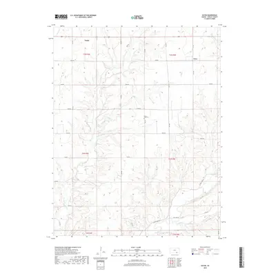
2018 Map of Eaton
USGS Topo · Published 2018About this map
Tisdale and Eaton anchor this rural Cowley County landscape, where the terrain is defined by a dense network of drainage systems feeding into Grouse Creek. The map shows a classic section-line road grid, including 181st RD and Grouse Creek RD, which provides access to the dispersed homesteads and agricultural lands of south-central Kansas. Near the center of the quadrangle, the Prairie Ridge Cem sits on a high point overlooking the headwaters of Harper Cr.
Find a feature on this map
40 named features on this map. Tap any name to fly to it.
Don’t see what you’re looking for? This feature index may not catch every label — zoom into the map to look around manually.
Map Details
Editions of this 2018 Eaton Map
This is the sole edition of this map. No revisions or reprints were ever made.
Other maps of this area

1889 · Burden
USGS Topo · 1:125,000

1955 · Wichita
USGS Topo · 1:250,000

1958 · Wichita
USGS Topo · 1:250,000

1962 · Dexter SW
USGS Topo · 1:24,000

1962 · Dexter
USGS Topo · 1:24,000

1962 · Cambridge
USGS Topo · 1:24,000

1964 · Burden
USGS Topo · 1:24,000
1964 · Maple City
USGS Topo · 1:24,000

1965 · Silverdale
USGS Topo · 1:24,000

1965 · Eaton
USGS Topo · 1:24,000