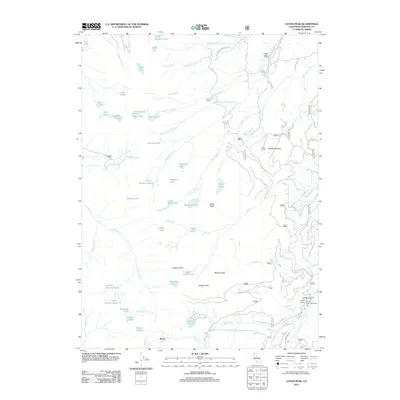
2012 Map of Eaton Peak
USGS Topo · Published 2012About this map
Foster sits in the southern reaches of this Siskiyou County landscape, a terrain defined by high-altitude granite peaks and a dense network of glacial lakes and alpine creeks. The region is characterized by prominent summits such as Russian Peak, Wildcat Peak, and Eaton Peak, which overlook a wilderness carved by the headwaters of Taylor Cr, French Cr, and the N Fork Horse Range Cr. This 2012 survey illustrates the remote character of the area, where isolated outposts like Eton Ranch, J H Ranch, and Hidden Valley Ranch are connected by rugged tracks such as the N Fork French Ck Rd.
Find a feature on this map
62 named features on this map. Tap any name to fly to it.
Don’t see what you’re looking for? This feature index may not catch every label — zoom into the map to look around manually.
Map Details
Editions of this 2012 Eaton Peak Map
This is the sole edition of this map. No revisions or reprints were ever made.
Other maps of this area

1886 · Shasta
USGS Topo · 1:250,000

1894 · Shasta
USGS Topo · 1:250,000

1923 · Sawyers Bar
USGS Topo · 1:125,000

1931 · Etna
USGS Topo · 1:96,000

1934 · Etna
USGS Topo · 1:125,000

1948 · Weed
USGS Topo · 1:250,000

1950 · Weed
USGS Topo · 1:250,000

1955 · Cecilville
USGS Topo · 1:62,500

1955 · Sawyers Bar
USGS Topo · 1:62,500

1955 · Etna
USGS Topo · 1:62,500