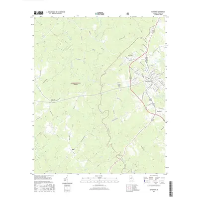
2017 Map of Eatonton
USGS Topo · Published 2017About this map
The city of Eatonton serves as the focal point of this Putnam County survey, illustrating the modern layout of this historic Georgia community. The landscape is defined by the winding course of the Little River, which snakes through the center of the quadrangle before reaching the northern reaches of Lake Sinclair in the south. To the west, the protected timberlands of the Oconee National Forest cover a significant portion of the terrain, interspersed with local settlements like Willard and Note. The map reveals the area's agricultural and water management history through features like the Rooty Cr Structure Number 21 Lake and Rooty Cr Structure Number Five Lake. For those tracing local heritage, the survey documents established sites such as Pine Grove Cem and Crestlawn Memorial Gardens, alongside the smaller communities of Imperial and Warfield.
Find a feature on this map
79 named features on this map. Tap any name to fly to it.
Don’t see what you’re looking for? This feature index may not catch every label — zoom into the map to look around manually.
Map Details
Editions of this 2017 Eatonton Map
This is the sole edition of this map. No revisions or reprints were ever made.
Other maps of this area

1953 · Athens
USGS Topo · 1:250,000

1958 · Athens
USGS Topo · 1:250,000

1959 · Athens
USGS Topo · 1:250,000

1963 · Athens
USGS Topo · 1:250,000

1964 · Stanfordville
USGS Topo · 1:24,000

1972 · Meda
USGS Topo · 1:24,000

1972 · Eatonton
USGS Topo · 1:24,000

1972 · Shady Dale
USGS Topo · 1:24,000
1972 · Smithboro
USGS Topo · 1:24,000

1972 · Harmony
USGS Topo · 1:24,000