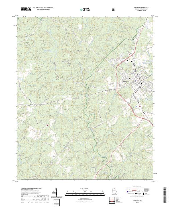
2024 Map of Eatonton
USGS Topo · Published 2024About this map
Eatonton serves as the focal point of this Putnam County landscape, where the historic Putnam County Courthouse stands at the center of a dense street grid. To the west, the protected woodlands of the Oconee National Forest dominate the terrain, dissected by the winding courses of the Little River and its many tributaries like Glady Creek and Pearson Creek. The map documents a blend of established municipal life and rural industry, with outlying settlements such as Willard and Imperial connected by a network of county roads.
Find a feature on this map
88 named features on this map. Tap any name to fly to it.
Don’t see what you’re looking for? This feature index may not catch every label — zoom into the map to look around manually.
Map Details
Editions of this 2024 Eatonton Map
This is the sole edition of this map. No revisions or reprints were ever made.
Other maps of this area

1953 · Athens
USGS Topo · 1:250,000

1958 · Athens
USGS Topo · 1:250,000

1959 · Athens
USGS Topo · 1:250,000

1963 · Athens
USGS Topo · 1:250,000

1964 · Stanfordville
USGS Topo · 1:24,000

1972 · Meda
USGS Topo · 1:24,000

1972 · Eatonton
USGS Topo · 1:24,000

1972 · Shady Dale
USGS Topo · 1:24,000
1972 · Smithboro
USGS Topo · 1:24,000

1972 · Harmony
USGS Topo · 1:24,000