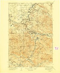
1937 Map of Eatonville
USGS Topo · Published 1937About this map
Timber and rail define this Washington landscape during the mid-1930s, where the Chicago Milwaukee St Paul and Pacific railroad winds through the river valleys of the Nisqually River and Cowlitz River. The settlement of Eatonville serves as a central hub, supported by smaller timber and mining communities like Mineral and Morton. This era highlights the industrial infrastructure of the Pacific Northwest, including a Lumber Flume near the Puyallup River and the Add Mine near Mineral Lake.
Find a feature on this map
151 named features on this map. Tap any name to fly to it.
Don’t see what you’re looking for? This feature index may not catch every label — zoom into the map to look around manually.
Map Details
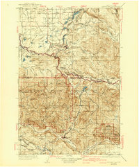
Editions of this 1937 Eatonville Map
3 editions found
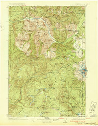
Other maps of this area

1897 · Tacoma
USGS Topo · 1:125,000

1900 · Tacoma
USGS Topo · 1:125,000

1913 · Cedar Lake
USGS Topo · 1:125,000

1916 · Chehalis
USGS Topo · 1:125,000

1919 · Mount St Helens
USGS Topo · 1:125,000

1924 · Mt Rainier
USGS Topo · 1:96,000

1926 · Steamboat Mtn
USGS Topo · 1:125,000

1928 · Mt Rainier
USGS Topo · 1:125,000
1931 · Steamboat Mtn
USGS Topo · 1:125,000

1937 · Eatonville
USGS Topo · 1:125,000