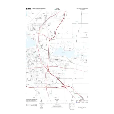
2013 Map of Eau Claire East
USGS Topo · Published 2013About this map
The confluence of the Chippewa River and the Eau Claire River anchors this 2013 survey of the eastern half of the city. Modern infrastructure, including the Chippewa Valley Regional Airport and the complex intersections of Hastings Way, dominates the northern and western sections, yet the landscape retains significant water features like Altoona Lake and Dells Pond. Residential growth is evident in established neighborhoods such as Altoona, Pinehurst, and Putnam Heights, while elevations like Mount Tom provide vertical contrast to the river valley.
Find a feature on this map
232 named features on this map. Tap any name to fly to it.
Don’t see what you’re looking for? This feature index may not catch every label — zoom into the map to look around manually.
Map Details
Editions of this 2013 Eau Claire East Map
This is the sole edition of this map. No revisions or reprints were ever made.
Other maps of this area

1927 · Strum
USGS Topo · 1:62,500

1930 · Strum
USGS Topo · 1:62,500

1932 · Mondovi
USGS Topo · 1:62,500

1934 · Elk Mound
USGS Topo · 1:62,500

1934 · Chippewa Falls
USGS Topo · 1:62,500

1936 · Chippewa Falls
USGS Topo · 1:62,500

1936 · Elk Mound
USGS Topo · 1:62,500

1953 · Eau Claire
USGS Topo · 1:250,000

1958 · Eau Claire
USGS Topo · 1:250,000

1964 · Eau Claire
USGS Topo · 1:250,000