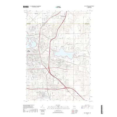
2018 Map of Eau Claire East
USGS Topo · Published 2018About this map
Eau Claire and Altoona converge at the confluence of major waterways and rail lines in this modern topographic study. The landscape is defined by the Chippewa River and the Eau Claire River, which feed into Dells Pond and are joined by smaller tributaries like Little Niagara Creek and Otter Creek. The urban footprint is dense with street grids reaching toward Pinehurst and Lake Hallie to the north, while the Union Pacific Railroad cuts through the terrain. Significant local landmarks include Mt Tom, which serves as a prominent geographic anchor, and the sprawling grounds of Forest Hill Cemetery and Calvary Catholic Cemetery. South of the rivers, a network of recreational paths including The Pines and Holy Roller shows the integration of wooded areas within the expanding municipal boundaries of Seymour and its neighbors.
Find a feature on this map
165 named features on this map. Tap any name to fly to it.
Don’t see what you’re looking for? This feature index may not catch every label — zoom into the map to look around manually.
Map Details
Editions of this 2018 Eau Claire East Map
This is the sole edition of this map. No revisions or reprints were ever made.
Other maps of this area

1927 · Strum
USGS Topo · 1:62,500

1930 · Strum
USGS Topo · 1:62,500

1932 · Mondovi
USGS Topo · 1:62,500

1934 · Elk Mound
USGS Topo · 1:62,500

1934 · Chippewa Falls
USGS Topo · 1:62,500

1936 · Chippewa Falls
USGS Topo · 1:62,500

1936 · Elk Mound
USGS Topo · 1:62,500

1953 · Eau Claire
USGS Topo · 1:250,000

1958 · Eau Claire
USGS Topo · 1:250,000

1964 · Eau Claire
USGS Topo · 1:250,000