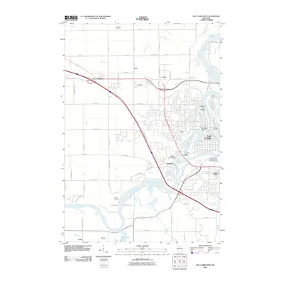
2010 Map of Eau Claire West
USGS Topo · Published 2010About this map
The Chippewa River winds through the heart of this Wisconsin landscape, anchoring the development of Eau Claire and its surrounding neighborhoods. Along the river's eastern banks, the University of Wisconsin - Eau Claire Campus and Putnam Heights represent the city's modern educational and residential footprint, while the Dells Dam and Dells 1907C35 Dam mark the engineered control of the waterway. West of the river, the terrain rises toward Mount Washington and Mount Simon, overlooking established communities like Shawtown and Union. Recreation and local history intersect at sites such as the Silver Mine Hill Ski Jump and Half Moon Beach on Halfmoon Lake. The map also captures several traditional burial grounds, including McCombs Cemetery, Lakeview Cemetery, and Brunswick Cemetery, providing vital landmarks for genealogical research near the Lufkin and Truax areas.
Find a feature on this map
46 named features on this map. Tap any name to fly to it.
Don’t see what you’re looking for? This feature index may not catch every label — zoom into the map to look around manually.
Map Details
Editions of this 2010 Eau Claire West Map
This is the sole edition of this map. No revisions or reprints were ever made.
Other maps of this area

1927 · Strum
USGS Topo · 1:62,500

1930 · Strum
USGS Topo · 1:62,500

1932 · Mondovi
USGS Topo · 1:62,500

1934 · Elk Mound
USGS Topo · 1:62,500

1934 · Chippewa Falls
USGS Topo · 1:62,500

1936 · Chippewa Falls
USGS Topo · 1:62,500

1936 · Elk Mound
USGS Topo · 1:62,500

1953 · Eau Claire
USGS Topo · 1:250,000

1958 · Eau Claire
USGS Topo · 1:250,000

1964 · Eau Claire
USGS Topo · 1:250,000