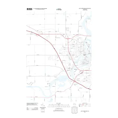
2013 Map of Eau Claire West
USGS Topo · Published 2013About this map
The Chippewa River carves a winding path through this 2013 western section of Eau Claire, defining the landscape between the downtown area and the more rural stretches of Union and Truax. Notable landmarks like the Silver Mine Hill Ski Jump and the Gemini Drive-In reflect the region's recreational history, while the oxbow of Half Moon Lake 2.54 and its adjacent Half Moon Beach mark the transition from industrial riverfront to residential space. The terrain is punctuated by local high points such as Mount Simon and Mount Washington, which offer perspective over the growing suburban street grid that pushes westward toward Silvermine Farms. Transportation networks, including Us-12 and Wi-312, intersect with older local routes like N Clairemont Ave, showing the integration of modern highways into the established river-city layout.
Find a feature on this map
145 named features on this map. Tap any name to fly to it.
Don’t see what you’re looking for? This feature index may not catch every label — zoom into the map to look around manually.
Map Details
Editions of this 2013 Eau Claire West Map
This is the sole edition of this map. No revisions or reprints were ever made.
Other maps of this area

1927 · Strum
USGS Topo · 1:62,500

1930 · Strum
USGS Topo · 1:62,500

1932 · Mondovi
USGS Topo · 1:62,500

1934 · Elk Mound
USGS Topo · 1:62,500

1934 · Chippewa Falls
USGS Topo · 1:62,500

1936 · Chippewa Falls
USGS Topo · 1:62,500

1936 · Elk Mound
USGS Topo · 1:62,500

1953 · Eau Claire
USGS Topo · 1:250,000

1958 · Eau Claire
USGS Topo · 1:250,000

1964 · Eau Claire
USGS Topo · 1:250,000