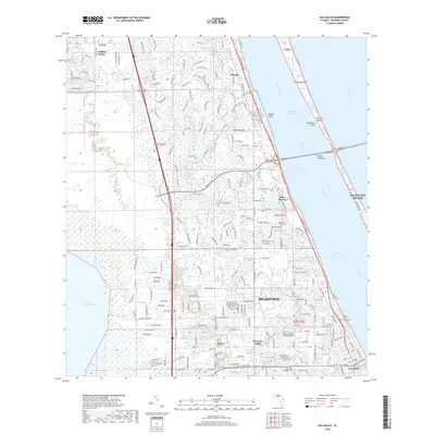
2018 Map of Eau Gallie
USGS Topo · Published 2018About this map
The Indian River Lagoon and Intracoastal Waterway define this coastal Florida landscape, where the Atlantic barrier island system meets the mainland at Satellite Beach. This modern survey documents the significant suburban growth and infrastructure connecting the mainland to Merritt Island, specifically via the Pineda Causeway and the Eau Gallie Blvd corridor. The geography transitions from the residential developments of Viera West and Pineda in the north to the established neighborhoods of Melbourne and Aurora further south.
Find a feature on this map
29 named features on this map. Tap any name to fly to it.
Don’t see what you’re looking for? This feature index may not catch every label — zoom into the map to look around manually.
Map Details
Editions of this 2018 Eau Gallie Map
This is the sole edition of this map. No revisions or reprints were ever made.
Other maps of this area

1949 · Melbourne West
USGS Topo · 1:24,000

1949 · Melbourne East
USGS Topo · 1:24,000

1949 · Eau Gallie
USGS Topo · 1:24,000

1949 · Cocoa
USGS Topo · 1:24,000

1949 · Cocoa Beach
USGS Topo · 1:24,000

1949 · Tropic
USGS Topo · 1:24,000

1951 · Melbourne East
USGS Topo · 1:24,000

1951 · Eau Gallie
USGS Topo · 1:24,000

1951 · Cocoa
USGS Topo · 1:24,000

1951 · Melbourne West
USGS Topo · 1:24,000