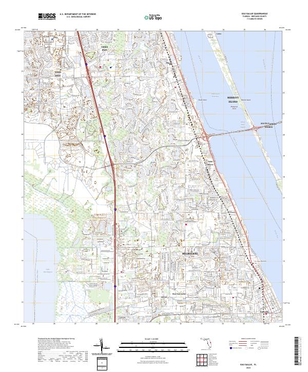
2024 Map of Eau Gallie
USGS Topo · Published 2024About this map
Melbourne and the surrounding Space Coast communities are captured in this contemporary topographic survey, showcasing the dense residential and institutional development of eastern Florida. The map documents the intricate waterways separating the mainland from Merritt Island, including the Intracoastal Waterway and the Banana River. High-density growth is evident in planned communities like Viera East and Viera West, anchored by the Brevard County Moore Justice Center. This suburban landscape is balanced by significant educational and civic sites, notably the Eastern Florida State College Melbourne Campus. Genealogists will find the locations of the Eau Gallie Cem and J. N. Tucker Memorial Cem essential for local family research. The terrain is defined by its relationship to water, from the expansive Lake Washington on the west to the coastal interface at South Patrick Shores on the Atlantic side.
Find a feature on this map
34 named features on this map. Tap any name to fly to it.
Don’t see what you’re looking for? This feature index may not catch every label — zoom into the map to look around manually.
Map Details
Editions of this 2024 Eau Gallie Map
This is the sole edition of this map. No revisions or reprints were ever made.
Other maps of this area

1949 · Melbourne West
USGS Topo · 1:24,000

1949 · Melbourne East
USGS Topo · 1:24,000

1949 · Eau Gallie
USGS Topo · 1:24,000

1949 · Cocoa
USGS Topo · 1:24,000

1949 · Cocoa Beach
USGS Topo · 1:24,000

1949 · Tropic
USGS Topo · 1:24,000

1951 · Melbourne East
USGS Topo · 1:24,000

1951 · Eau Gallie
USGS Topo · 1:24,000

1951 · Cocoa
USGS Topo · 1:24,000

1951 · Melbourne West
USGS Topo · 1:24,000