
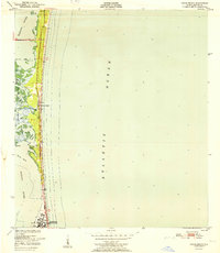
1951 Map of Eau Gallie
USGS Topo · Published 1951About this map
Eau Gallie and its surrounding wetlands occupy a central role in this mid-century survey of coastal Brevard County. The town is situated at the confluence of the Indian River and Elbow Creek, where the Florida East Coast railway runs parallel to the shore. The landscape is characterized by the complex hydrology of the region, stretching from the eastern edge of Lake Washington across low-lying marshes and prairies to the barrier systems of Merrill Island.
Find a feature on this map
18 named features on this map. Tap any name to fly to it.
Don’t see what you’re looking for? This feature index may not catch every label — zoom into the map to look around manually.
Map Details
Editions of this 1951 Eau Gallie Map
This is the sole edition of this map. No revisions or reprints were ever made.
Other maps of this area

1949 · Melbourne West
USGS Topo · 1:24,000

1949 · Melbourne East
USGS Topo · 1:24,000

1949 · Eau Gallie
USGS Topo · 1:24,000

1949 · Cocoa
USGS Topo · 1:24,000

1949 · Cocoa Beach
USGS Topo · 1:24,000

1949 · Tropic
USGS Topo · 1:24,000

1951 · Melbourne East
USGS Topo · 1:24,000

1951 · Cocoa
USGS Topo · 1:24,000

1951 · Melbourne West
USGS Topo · 1:24,000
1951 · Cocoa Beach
USGS Topo · 1:24,000