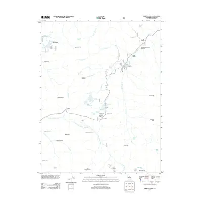
2012 Map of Ebbetts Pass
USGS Topo · Published 2012About this map
Ebbetts Pass serves as a high-altitude thoroughfare in this 2012 study, where the highway winds through complex topography between the N Fork Mokelumne River and the headwaters of Silver Cr. The area is characterized by massive granite formations like Raymond Peak and Highland Peak, while the cultural landscape is defined by recreation and historical markers. The Silver Mountain Mineral Monument near IXL Canyon stands as a reference to the region's mining heritage. Numerous alpine meadows and small basins, such as Bloomfield Meadow and Milk Ranch Meadow, dot the landscape, offering a look at the natural watering points and summer grazing flats that historically supported seasonal travel. Modern trail infrastructure is evident at the Pacific Crest Trailhead and the Ebbetts Pass Trailhead, while established sites like Silver Creek Campground mark the transition from resource extraction to leisure.
Find a feature on this map
53 named features on this map. Tap any name to fly to it.
Don’t see what you’re looking for? This feature index may not catch every label — zoom into the map to look around manually.
Map Details
Editions of this 2012 Ebbetts Pass Map
This is the sole edition of this map. No revisions or reprints were ever made.
Other maps of this area

1889 · Markleeville
USGS Topo · 1:125,000

1891 · Markleeville
USGS Topo · 1:125,000

1893 · Markleeville
USGS Topo · 1:125,000

1896 · Dardanelles
USGS Topo · 1:125,000

1898 · Dardanelles
USGS Topo · 1:125,000

1948 · Walker Lake
USGS Topo · 1:250,000

1956 · Topaz Lake
USGS Topo · 1:62,500

1956 · Markleeville
USGS Topo · 1:62,500

1956 · Dardanelles Cone
USGS Topo · 1:62,500

1956 · Sonora Pass
USGS Topo · 1:62,500