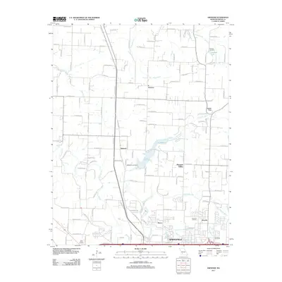
2011 Map of Ebenezer
USGS Topo · Published 2011About this map
Springfield extends its northern footprint into this landscape of small settlements and reservoir waters in 2011. The city's northern outskirts give way to established rural communities like Ebenezer, Glidewell, and Pleasant Valley, while recreational spaces such as the Grandview Golf Course and Avalon Park mark the transition from urban to countryside. The hydrology of the region is centered on the Little Sac River and the substantial Lake McDaniel, which is held by the McDaniel Lake Dam. Smaller waterways including the South Dry Sac River and Pea Ridge Creek weave through the terrain, supporting the agricultural grid defined by an extensive network of farm roads.
Find a feature on this map
69 named features on this map. Tap any name to fly to it.
Don’t see what you’re looking for? This feature index may not catch every label — zoom into the map to look around manually.
Map Details
Editions of this 2011 Ebenezer Map
This is the sole edition of this map. No revisions or reprints were ever made.
Other maps of this area

1884 · Springfield
USGS Topo · 1:125,000

1886 · Springfield
USGS Topo · 1:125,000

1935 · Springfield
USGS Topo · 1:24,000

1936 · Brookline
USGS Topo · 1:24,000

1937 · Galloway
USGS Topo · 1:24,000

1937 · Ozark
USGS Topo · 1:48,000

1943 · Ozark
USGS Topo · 1:62,500

1945 · Ozark
USGS Topo · 1:62,500

1946 · Bassville
USGS Topo · 1:24,000

1947 · Strafford
USGS Topo · 1:62,500