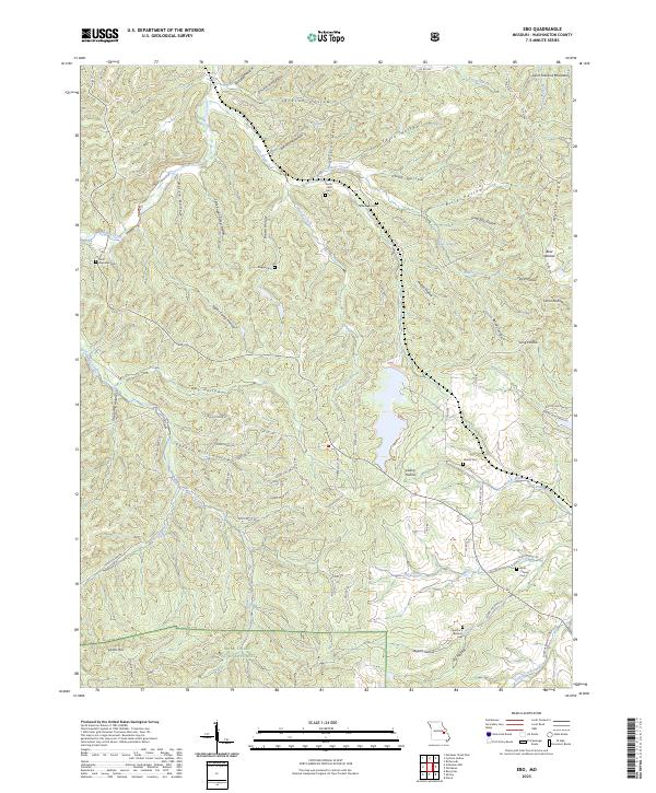
2023 Map of Ebo
USGS Topo · Published 2023About this map
Indian Creek and Brushy Fork wind through the heavily wooded terrain of the Mark Twain National Forest in this 2023 survey of Washington County. The landscape is defined by the sharp relief of the Saint Francois Mountains, carved by a dense network of hollows such as Grady Mill Hollow, Jackson Hollow, and Billy Hollow. Family history is deeply rooted here, evidenced by numerous small burial sites scattered across the ridges, including Souls Chapel Cem, Smith-Witt Cem, and Scott-Reynolds Cem.
Find a feature on this map
76 named features on this map. Tap any name to fly to it.
Don’t see what you’re looking for? This feature index may not catch every label — zoom into the map to look around manually.
Map Details
Editions of this 2023 Ebo Map
This is the sole edition of this map. No revisions or reprints were ever made.
Other maps of this area

1901 · De Soto
USGS Topo · 1:125,000

1903 · Sullivan
USGS Topo · 1:125,000

1906 · Potosi
USGS Topo · 1:62,500

1934 · Meramec State Park
USGS Topo · 1:24,000

1937 · Meramec State Park
USGS Topo · 1:24,000

1943 · Berryman
USGS Topo · 1:62,500

1945 · Berryman
USGS Topo · 1:62,500

1946 · Richwoods
USGS Topo · 1:62,500

1947 · Sullivan
USGS Topo · 1:62,500

1948 · Richwoods
USGS Topo · 1:62,500