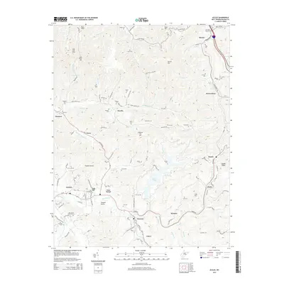
2014 Map of Eccles
USGS Topo · Published 2014About this map
Stephens Lake dominates the central landscape of this Raleigh County region, where the steep drainages of the Appalachian Plateau meet established mountain communities. The geography is defined by a dense network of family-named cemeteries, such as the Davis-Bailey Homestead Cem and Wiseman Cem, which provide a clear record of local lineage across the ridges and hollows. Key settlements like Glen Daniel, Eccles, and Surveyor sit at the nexus of local transport routes like the Coal River Rd and Harper Rd. To the north, the terrain rises sharply toward Coal River Mtn and Packs Knob, with the Clear Fork and Spruce Fork carving deep valleys. This 2014 survey captures the persistence of traditional coal-country settlement patterns, where small villages remain anchored to the winding valley floors beneath landmarks like Chestnut Flat Mtn.
Find a feature on this map
88 named features on this map. Tap any name to fly to it.
Don’t see what you’re looking for? This feature index may not catch every label — zoom into the map to look around manually.
Map Details
Editions of this 2014 Eccles Map
This is the sole edition of this map. No revisions or reprints were ever made.
Other maps of this area

1891 · Raleigh
USGS Topo · 1:125,000

1897 · Raleigh
USGS Topo · 1:125,000

1902 · Raleigh
USGS Topo · 1:125,000

1911 · Marshes
USGS Topo · 1:48,000

1911 · Flattop
USGS Topo · 1:48,000

1911 · Beckley
USGS Topo · 1:48,000

1912 · Mullens
USGS Topo · 1:62,500

1913 · Beckley
USGS Topo · 1:62,500

1914 · Eccles
USGS Topo · 1:62,500

1914 · Flattop
USGS Topo · 1:62,500