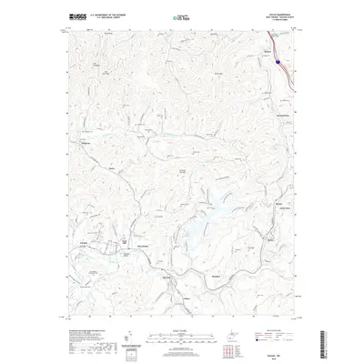
2019 Map of Eccles
USGS Topo · Published 2019About this map
Coal River Mountain and Spruce Mountain define the high terrain of Raleigh County, where the headwaters of numerous creeks carve a complex landscape of hollows and ridges. This 2019 survey documents the enduring footprint of small communities like Glen Daniel, Fairdale, and Eccles, which are connected by a network of winding state routes and local roads such as Co Rte 11 and Harper Road. The map is particularly notable for its density of family and community burial grounds, including the Davis-Bailey Homestead Cemetery, Biggs Cemetery, and Trump Cemetery, offering a detailed view of local genealogy and land ownership patterns. Along the waterways of Marsh Fork and Surveyor Creek, the geography of the southern West Virginia coalfields is visible through named features like Claypool Hollow and various small settlements such as Sweeneyburg and Tolleys that follow the natural topography of the Appalachian plateau.
Find a feature on this map
141 named features on this map. Tap any name to fly to it.
Don’t see what you’re looking for? This feature index may not catch every label — zoom into the map to look around manually.
Map Details
Editions of this 2019 Eccles Map
This is the sole edition of this map. No revisions or reprints were ever made.
Other maps of this area

1891 · Raleigh
USGS Topo · 1:125,000

1897 · Raleigh
USGS Topo · 1:125,000

1902 · Raleigh
USGS Topo · 1:125,000

1911 · Marshes
USGS Topo · 1:48,000

1911 · Flattop
USGS Topo · 1:48,000

1911 · Beckley
USGS Topo · 1:48,000

1912 · Mullens
USGS Topo · 1:62,500

1913 · Beckley
USGS Topo · 1:62,500

1914 · Eccles
USGS Topo · 1:62,500

1914 · Flattop
USGS Topo · 1:62,500