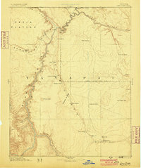
1886 Map of Echo Cliffs
USGS Topo · Published 1899About this map
Lee Ferry serves as the critical crossing point where the Colorado River meets Paria Canyon, a vital bottleneck for travelers and geographers in the late nineteenth century. This reconnaissance map details the convergence of the Little Colorado River and the main stem amidst the towering walls of Marble Canyon. The landscape is dominated by the massive rise of the Echo Cliffs and the Vermilion Cliffs, which channel travel along specific corridors between water sources like Navajo Spring and Bitter Spring.
Find a feature on this map
37 named features on this map. Tap any name to fly to it.
Don’t see what you’re looking for? This feature index may not catch every label — zoom into the map to look around manually.
Map Details
Editions of this 1886 Echo Cliffs Map
2 editions found
Other maps of this area

1883 · Marsh Pass
USGS Topo · 1:250,000

1883 · Tusayan
USGS Topo · 1:250,000

1886 · Kanab
USGS Topo · 1:250,000

1886 · Tusayan
USGS Topo · 1:250,000

1886 · Escalante
USGS Topo · 1:250,000

1886 · Henry Mountains
USGS Topo · 1:250,000

1886 · San Francisco Mtns
USGS Topo · 1:250,000

1886 · Chino
USGS Topo · 1:250,000

1886 · Echo Cliffs
USGS Topo · 1:250,000

1886 · Kaibab
USGS Topo · 1:250,000