
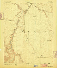
1886 Map of Echo Cliffs
USGS Topo · Published 1886About this map
Lee Ferry serves as the critical crossing point where the Colorado River separates the Paria Plateau from the rising Echo Cliffs in this northern Arizona territory. Surveyed under J.W. Powell, the landscape is defined by vast geological formations and the strategic placement of water sources in an arid environment. The map details a network of springs and tanks essential for travel and early settlement, including Navajo Spring, Bitter Spring, and Jacobs Pools along the base of the Vermilion Cliffs. To the south, the Mormon settlement of Tuba City and the Hopi village of Moencopie are situated near the Moencopie Wash, illustrating the convergence of indigenous and pioneer geography. The sheer verticality of the region is captured through the depths of Marble Canon and the prominent Shinumo Altar, marking a period before modern infrastructure altered these remote corridors.
Find a feature on this map
35 named features on this map. Tap any name to fly to it.
Don’t see what you’re looking for? This feature index may not catch every label — zoom into the map to look around manually.
Map Details
Editions of this 1886 Echo Cliffs Map
2 editions found
Other maps of this area

1883 · Marsh Pass
USGS Topo · 1:250,000

1883 · Tusayan
USGS Topo · 1:250,000

1886 · Kanab
USGS Topo · 1:250,000

1886 · Tusayan
USGS Topo · 1:250,000

1886 · Escalante
USGS Topo · 1:250,000

1886 · Henry Mountains
USGS Topo · 1:250,000

1886 · San Francisco Mtns
USGS Topo · 1:250,000

1886 · Chino
USGS Topo · 1:250,000

1886 · Kaibab
USGS Topo · 1:250,000

1891 · San Francisco Mtns
USGS Topo · 1:250,000