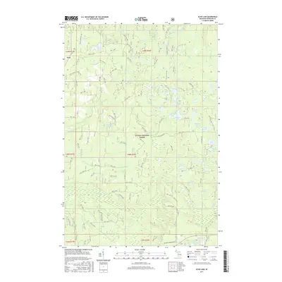
2017 Map of Echo Lake
USGS Topo · Published 2017About this map
Frost sits at the northwestern edge of this landscape, situated within the expansive Ottawa National Forest. This region is defined by an intricate network of glacial lakes and wetlands, connected by a maze of Forest Service roads such as Forest Rd 1501 and 2210 Forest Rd. The drainage pattern is complex, with Beaver Cr, Silver River, and Gurgle Cr winding through the timberland.
Find a feature on this map
114 named features on this map. Tap any name to fly to it.
Don’t see what you’re looking for? This feature index may not catch every label — zoom into the map to look around manually.
Map Details
Editions of this 2017 Echo Lake Map
This is the sole edition of this map. No revisions or reprints were ever made.
Other maps of this area

1895 · Perch Lake
USGS Topo · 1:62,500

1954 · Rousseau
USGS Topo · 1:62,500

1954 · Kenton
USGS Topo · 1:62,500

1954 · Perch Lake
USGS Topo · 1:62,500

1954 · Sidnaw
USGS Topo · 1:62,500

1958 · Iron River
USGS Topo · 1:250,000

1960 · Iron River
USGS Topo · 1:250,000

1961 · Iron River
USGS Topo · 1:250,000

1967 · Iron River
USGS Topo · 1:250,000
1982 · Sparrow Rapids
USGS Topo · 1:25,000