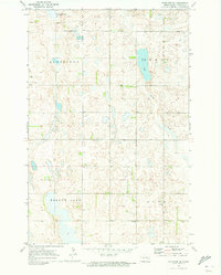
1970 Map of Eckelson SE
USGS Topo · Published 1973About this map
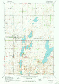
The glacial prairie pothole region of North Dakota is captured here in the early 1970s, defined by the rural townships of Mansfield and Svea. The landscape is dominated by scattered depressions and wetlands typical of the drift plain, most notably the elongated Kee Lake in the north and the expansive Meadow Lake to the south. These water bodies, along with the meandering path of Spring Creek, provide essential habitat for migratory birds, protected in part by the National Wildlife Management Area in the northwest corner.
Find a feature on this map
11 named features on this map. Tap any name to fly to it.
Don’t see what you’re looking for? This feature index may not catch every label — zoom into the map to look around manually.
Map Details
Editions of this 1970 Eckelson SE Map
This is the sole edition of this map. No revisions or reprints were ever made.
Other maps of this area

1897 · Eckelson
USGS Topo · 1:125,000

1953 · Jamestown
USGS Topo · 1:250,000

1956 · Jamestown
USGS Topo · 1:250,000

1970 · Litchville
USGS Topo · 1:24,000

1970 · Eckelson
USGS Topo · 1:24,000
1970 · Spiritwood
USGS Topo · 1:24,000
1970 · Moon Lake
USGS Topo · 1:24,000

1970 · Marion NE
USGS Topo · 1:24,000
1970 · Marion NW
USGS Topo · 1:24,000
1970 · Sanborn
USGS Topo · 1:24,000