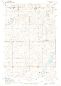
1970 Map of Spiritwood
USGS Topo · Published 1973About this map
Spiritwood and the smaller siding of Urbana anchor this section of the North Dakota prairie along the Burlington Northern railroad line. The landscape is defined by the Stutsman and Barnes County border, which bisects several townships including Rose, Brimer, and Mansfield. Significant water bodies such as Rush Island Lake, Island Lake, and Goose Lake are prominent features, several of which fall within the National Wildlife Management Area. The presence of a Pipeline and multiple Gravel Pits reflects the infrastructure and resource extraction of the era, while a lone Radio Tower stands as a distinct landmark near the tracks. The grid of section lines and fence borders illustrates the systematic agricultural partitioning of the Great Plains as it remained in the early 1970s.
Find a feature on this map
19 named features on this map. Tap any name to fly to it.
Don’t see what you’re looking for? This feature index may not catch every label — zoom into the map to look around manually.
Map Details
Editions of this 1970 Spiritwood Map
This is the sole edition of this map. No revisions or reprints were ever made.
Other maps of this area

1896 · Jamestown
USGS Topo · 1:125,000

1897 · Eckelson
USGS Topo · 1:125,000

1900 · Pingree
USGS Topo · 1:125,000

1951 · Spiritwood Lake
USGS Topo · 1:24,000

1952 · Ypsilanti
USGS Topo · 1:24,000

1952 · Bloom
USGS Topo · 1:24,000

1952 · New Rockford
USGS Topo · 1:250,000

1953 · Jamestown
USGS Topo · 1:250,000

1956 · New Rockford
USGS Topo · 1:250,000

1956 · Jamestown
USGS Topo · 1:250,000