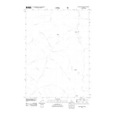
2011 Map of Edaho Mountain
USGS Topo · Published 2011About this map
The South Fork Payette River and the North Fork Boise River headwaters dominate this high-country landscape in Elmore County. This modern survey illustrates the intricate drainage network defining the region, where numerous named tributaries such as McPhearson Creek, McLeod Creek, and Wapiti Creek carve through the terrain. Evidence of human presence is sparse but specific, centered on the Deadman Cabin located near the northeastern river bend and Big Meadows.
Find a feature on this map
22 named features on this map. Tap any name to fly to it.
Don’t see what you’re looking for? This feature index may not catch every label — zoom into the map to look around manually.
Map Details
Editions of this 2011 Edaho Mountain Map
This is the sole edition of this map. No revisions or reprints were ever made.
Other maps of this area

1891 · Bear Valley
USGS Topo · 1:125,000

1893 · Bear Valley
USGS Topo · 1:125,000

1894 · Rocky Bar
USGS Topo · 1:125,000

1955 · Hailey
USGS Topo · 1:250,000

1957 · Challis
USGS Topo · 1:250,000

1959 · Hailey
USGS Topo · 1:250,000

1960 · Challis
USGS Topo · 1:250,000

1962 · Hailey
USGS Topo · 1:250,000

1963 · Challis
USGS Topo · 1:250,000
1972 · Tyee Mountain
USGS Topo · 1:24,000