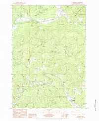
1984 Map of Eddyville
USGS Topo · Published 1984About this map
The Siletz River winds through the northern portion of this landscape, carving a deep valley that defines the local geography. This 1980s survey captures a region where timber and transportation intersect, characterized by the rugged terrain of the Siletz Indian Reservation. To the south, the Yaquina River provides a secondary drainage basin, paralleled by the tracks of the Southern Pacific railroad, which historically served the movement of goods through the Coastal Range.
Find a feature on this map
54 named features on this map. Tap any name to fly to it.
Don’t see what you’re looking for? This feature index may not catch every label — zoom into the map to look around manually.
Map Details
Editions of this 1984 Eddyville Map
This is the sole edition of this map. No revisions or reprints were ever made.
Other maps of this area

1939 · Marys Peak
USGS Topo · 1:62,500

1942 · Euchre Mtn
USGS Topo · 1:62,500

1942 · Marys Peak
USGS Topo · 1:62,500

1942 · Valsetz
USGS Topo · 1:62,500

1942 · Toledo
USGS Topo · 1:62,500

1943 · Euchre Mtn
USGS Topo · 1:62,500

1953 · Salem
USGS Topo · 1:250,000

1954 · Salem
USGS Topo · 1:250,000

1956 · Valsetz
USGS Topo · 1:62,500

1957 · Marys Peak
USGS Topo · 1:62,500