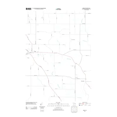
2013 Map of Eden
USGS Topo · Published 2013About this map
Eden and Waucousta serve as the primary hubs in this section of Fond du Lac County, where the agricultural landscape is divided by significant glacial and fluvial features. The drainage divide is evident here as the Sheboygan River flows toward Lake Michigan in the northeast while the Milwaukee River begins its southward journey. Transport in the early 21st century follows a mix of modern infrastructure and traditional routes, with Us-45 and Fond Du Lac Ave intersecting at the heart of Eden. Smaller landmarks like Dinnerbell Airport and the Twin Lakes basin highlight the localized geography that defined land use and settlement patterns long after the initial pioneer era. The map's grid of roads, including County Hwy-V and County Hwy-W, reflects the enduring township-and-range survey system that organizes this rural Wisconsin territory.
Find a feature on this map
53 named features on this map. Tap any name to fly to it.
Don’t see what you’re looking for? This feature index may not catch every label — zoom into the map to look around manually.
Map Details
Editions of this 2013 Eden Map
This is the sole edition of this map. No revisions or reprints were ever made.
Other maps of this area

1910 · Fond du Lac
USGS Topo · 1:62,500

1954 · Kiel
USGS Topo · 1:62,500

1955 · Campbellsport
USGS Topo · 1:62,500

1955 · Kewaskum
USGS Topo · 1:62,500

1955 · Fond Du Lac
USGS Topo · 1:62,500

1955 · Fond Du Lac
USGS Topo · 1:24,000

1957 · Madison
USGS Topo · 1:250,000

1960 · Madison
USGS Topo · 1:250,000

1974 · St. Cloud
USGS Topo · 1:24,000
1974 · Dundee
USGS Topo · 1:24,000