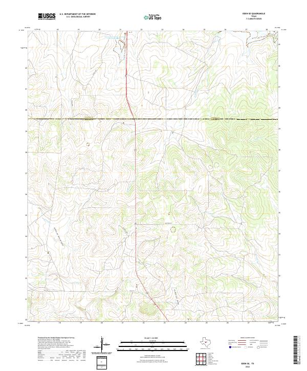
2022 Map of Eden SE
USGS Topo · Published 2022About this map
The Concho Co and Menard Co boundary line bisects this portion of the Texas Hill Country, a landscape defined by an intricate network of intermittent drainage ways and livestock water management. The northern reaches are anchored by the Soil Conservation Service Site 26 Reservoir, a key piece of infrastructure for managing the watershed of S Brady Cr. The terrain is deeply grooved by seasonal flows such as Arroyo de Juan Lorenzo and Volkmann Draw, which feed into larger systems like Celery Cr.
Find a feature on this map
13 named features on this map. Tap any name to fly to it.
Don’t see what you’re looking for? This feature index may not catch every label — zoom into the map to look around manually.
Map Details
Editions of this 2022 Eden SE Map
This is the sole edition of this map. No revisions or reprints were ever made.
Other maps of this area

1892 · Eden
USGS Topo · 1:125,000

1896 · Eden
USGS Topo · 1:125,000

1954 · Brownwood
USGS Topo · 1:250,000

1954 · Llano
USGS Topo · 1:250,000

1955 · Llano
USGS Topo · 1:250,000

1956 · Llano
USGS Topo · 1:250,000
1970 · Live Oak
USGS Topo · 1:24,000

1970 · Callan
USGS Topo · 1:24,000

1970 · Clear Creek Lake
USGS Topo · 1:24,000
1970 · Eden
USGS Topo · 1:24,000