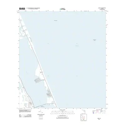
2012 Map of Eden
USGS Topo · Published 2012About this map
Hutchinson Island dominates this coastal landscape, separated from the Florida mainland by the waters of the Indian River. This barrier island setting includes established residential pockets such as Nettles Island and the coastal community of Waveland, characterized by a grid of streets including Michigan Ave and Nettles Blvd. On the western shore, the settlement of Eden sits near Lake Eden and Henderson Pond, connected to the Atlantic side by The Frank A Wacha Bridge.
Find a feature on this map
25 named features on this map. Tap any name to fly to it.
Don’t see what you’re looking for? This feature index may not catch every label — zoom into the map to look around manually.
Map Details
Editions of this 2012 Eden Map
This is the sole edition of this map. No revisions or reprints were ever made.
Other maps of this area

1948 · Palm City
USGS Topo · 1:24,000

1948 · Ankona
USGS Topo · 1:24,000

1948 · St. Lucie Inlet
USGS Topo · 1:24,000

1948 · Eden
USGS Topo · 1:24,000

1949 · Fort Pierce
USGS Topo · 1:24,000

1950 · St. Lucie Inlet
USGS Topo · 1:24,000

1950 · Ankona
USGS Topo · 1:24,000

1950 · Fort Pierce
USGS Topo · 1:24,000

1950 · Palm City
USGS Topo · 1:24,000
1950 · Eden
USGS Topo · 1:24,000