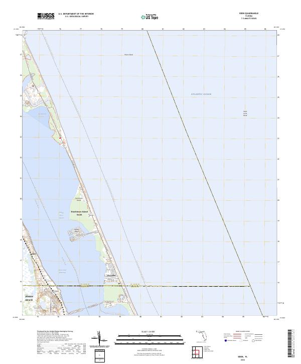
2024 Map of Eden
USGS Topo · Published 2024About this map
Hutchinson Island dominates the landscape of this Florida coastal survey, separating the Atlantic Ocean from the protected waters of the Indian River Lagoon. This stretch of the Treasure Coast shows the intricate relationship between modern development and recreational waterways, with communities like Hutchinson Island South and Waveland established along the barrier island. On the mainland, the historic settlement of Eden sits west of the Intracoastal Waterway, while Jensen Beach anchors the southern portion of the map. Navigation and natural preservation are central themes, evidenced by the Florida Circumnavigational Paddling Trail and the Ocean Bay Preserve Trail. Below the surface of the Atlantic, maritime hazards and fishing grounds such as Pierce Shoal and Saint Lucie Shoal are identified, serving as key markers for local mariners.
Find a feature on this map
32 named features on this map. Tap any name to fly to it.
Don’t see what you’re looking for? This feature index may not catch every label — zoom into the map to look around manually.
Map Details
Editions of this 2024 Eden Map
This is the sole edition of this map. No revisions or reprints were ever made.
Other maps of this area

1948 · Palm City
USGS Topo · 1:24,000

1948 · Ankona
USGS Topo · 1:24,000

1948 · St. Lucie Inlet
USGS Topo · 1:24,000

1948 · Eden
USGS Topo · 1:24,000

1949 · Fort Pierce
USGS Topo · 1:24,000

1950 · St. Lucie Inlet
USGS Topo · 1:24,000

1950 · Ankona
USGS Topo · 1:24,000

1950 · Fort Pierce
USGS Topo · 1:24,000

1950 · Palm City
USGS Topo · 1:24,000
1950 · Eden
USGS Topo · 1:24,000