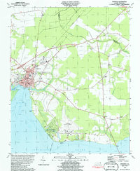
1981 Map of Edenton
USGS Topo · Published 1986About this map
Edenton sits at the confluence of Edenton Bay and the Albemarle Sound, a landscape shaped by coastal navigation and agricultural heritage. The town's grid is anchored by Queen St and Church St, leading down to the Seawall where colonial-era roots meet the 20th-century waterfront. To the east, the rural character persists around Yeopim and St Johns, where the landscape is bisected by the Norfolk Southern railroad. The map reveals a high density of community landmarks, including Beaver Hill Cem and Vine Oak Cem, which provide significant genealogical reference points. Educational and social infrastructure is evident through the presence of Walker Sch and Holmes High Sch, while the Edenton Municipal Airport near Horniblow Point marks the modernization of the county's transport network during this era.
Find a feature on this map
49 named features on this map. Tap any name to fly to it.
Don’t see what you’re looking for? This feature index may not catch every label — zoom into the map to look around manually.
Map Details
Editions of this 1981 Edenton Map
2 editions found
Other maps of this area

1904 · Edenton
USGS Topo · 1:62,500

1906 · Hertford
USGS Topo · 1:62,500

1940 · Hertford
USGS Topo · 1:62,500

1942 · Edenton
USGS Topo · 1:62,500

1943 · Columbia
USGS Topo · 1:125,000

1943 · Plymouth
USGS Topo · 1:125,000

1943 · Edenton
USGS Topo · 1:62,500

1953 · Norfolk
USGS Topo · 1:250,000

1953 · Rocky Mount
USGS Topo · 1:250,000

1954 · Rocky Mount
USGS Topo · 1:250,000