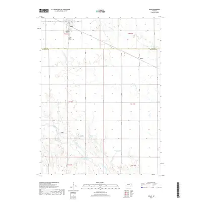
2017 Map of Edgar
USGS Topo · Published 2017About this map
Edgar serves as the primary hub of this agricultural landscape in southeastern Clay County, where the local road network follows a strict sectional grid interrupted only by the winding path of Big Sandy Cr. Just south of the town center, the Edgar Cem stands near the junction of several rural routes. The terrain is defined by the drainage basins of the Little Blue River and its tributaries, which have been modified by several significant water management projects. These include the Mazour-Schroeder Reservoir and Drohman Reservoir, which punctuate the prairie with managed water bodies. To the southeast, the small settlements of Sedan and Angus mark the transition into Nuckolls County, reflecting the historical pattern of small trade centers that supported the surrounding farmsteads.
Find a feature on this map
44 named features on this map. Tap any name to fly to it.
Don’t see what you’re looking for? This feature index may not catch every label — zoom into the map to look around manually.
Map Details
Editions of this 2017 Edgar Map
This is the sole edition of this map. No revisions or reprints were ever made.
Other maps of this area

1898 · Superior
USGS Topo · 1:125,000

1898 · Hebron
USGS Topo · 1:125,000

1955 · Lincoln
USGS Topo · 1:250,000

1955 · Grand Island
USGS Topo · 1:250,000

1957 · Lincoln
USGS Topo · 1:250,000

1957 · Grand Island
USGS Topo · 1:250,000

1958 · Grand Island
USGS Topo · 1:250,000

1958 · Lincoln
USGS Topo · 1:250,000

1960 · Edgar
USGS Topo · 1:24,000

1960 · Davenport
USGS Topo · 1:24,000