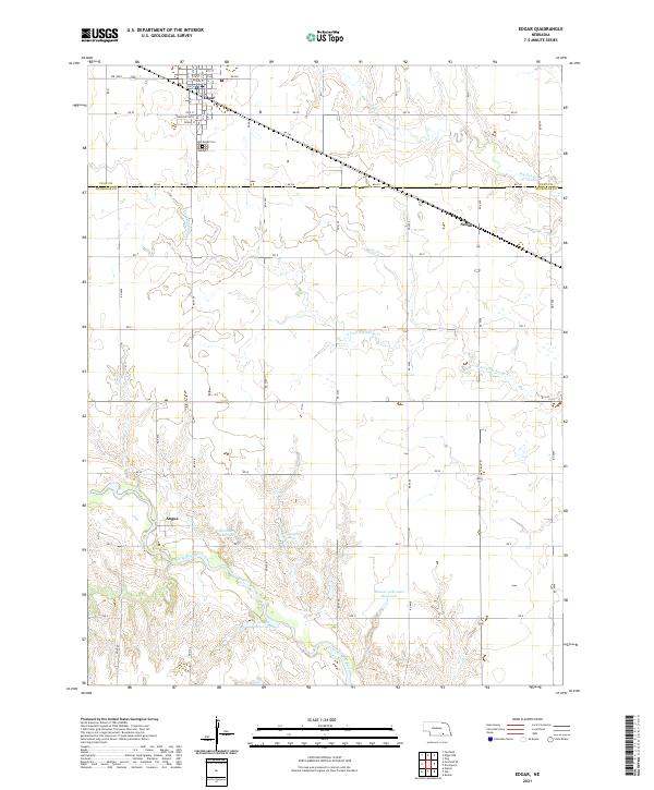
2021 Map of Edgar
USGS Topo · Published 2021About this map
The town of Edgar serves as the primary hub in this agricultural landscape of Clay and Nuckolls Counties. The community is laid out on a traditional grid, featuring the Edgar Cem on its southern edge. This 2021 survey reveals a region defined by its water management and drainage patterns, with the Little Blue River and Oxbow Cr winding through the southern sections. Smaller settlements like Angus and Sedan anchor the rural road network, while a series of modern reservoirs, including Mazour-Schroeder Reservoir, Mountford Lake, and Drohman Reservoir, highlight the local irrigation and conservation infrastructure. The branching tributaries of Big Sandy Cr and the S Fork Big Sandy Cr create a distinct dendritic pattern across the northern half of the map, illustrating the natural drainage toward the southeast.
Find a feature on this map
31 named features on this map. Tap any name to fly to it.
Don’t see what you’re looking for? This feature index may not catch every label — zoom into the map to look around manually.
Map Details
Editions of this 2021 Edgar Map
This is the sole edition of this map. No revisions or reprints were ever made.
Other maps of this area

1898 · Superior
USGS Topo · 1:125,000

1898 · Hebron
USGS Topo · 1:125,000

1955 · Lincoln
USGS Topo · 1:250,000

1955 · Grand Island
USGS Topo · 1:250,000

1957 · Lincoln
USGS Topo · 1:250,000

1957 · Grand Island
USGS Topo · 1:250,000

1958 · Grand Island
USGS Topo · 1:250,000

1958 · Lincoln
USGS Topo · 1:250,000

1960 · Edgar
USGS Topo · 1:24,000

1960 · Davenport
USGS Topo · 1:24,000